

Ipiales topographic map
Click on the map to display elevation.
Ipiales
Ipiales is a city and Catholic bishopric in Nariño Department, southern Colombia, near the border with Ecuador. It is located at around 0°49′49″N 77°38′40″W / 0.83028°N 77.64444°W / 0.83028; -77.64444, with an elevation of about 2950 m. Ipiales is located on the high plateau called "Tuquerres e Ipiales," the city lies at a distance of 82 km from Pasto, the department's capital." Ipiales is known as "la ciudad de las nubes verdes" (the city of the green clouds) because sometimes, especially in the afternoon, greenish clouds appear over the city. One of the area's favorite foods is the guinea pig or cavy (Cavia porcellus), called kuy or kuwi. The economy of this city is based on border trade between Ecuador and Colombia.
About this map
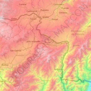
Name: Ipiales topographic map, elevation, terrain.
Location: Ipiales, Exprovincia de Obando, Nariño, RAP Pacífico, Colombia (0.36094 -77.69790 0.90359 -77.08800)
Average elevation: 2,902 m
Minimum elevation: 590 m
Maximum elevation: 4,699 m