Geolocate

Waldbrunn topographic map

Click on the map to display elevation.

About this map
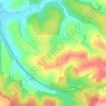
Name: Waldbrunn topographic map, elevation, terrain.

Location: Waldbrunn, Landkreis Würzburg, Bavaria, 97295, Germany (49.74200 9.76616 49.77833 9.81373)

Average elevation: 298 m

Minimum elevation: 245 m

Maximum elevation: 367 m

Other topographic maps

Click on a map to view its topography, its elevation and its terrain.

Dipbach

Germany > Bavaria > Landkreis Würzburg

Average elevation: 282 m

Obereisenheim

Germany > Bavaria > Landkreis Würzburg

Average elevation: 245 m

Gear up for your next adventure:

🧊Insulated Water Bottle - Keeps drinks cold in summer and prevents freezing in winter
🧰Multitool Knife - Compact and versatile tool for outdoor use
🧥Ultralight Puffy Jacket - Maximum warmth that packs down to the size of an orange
🧥Thermal Layer - Insulating layer for cold outdoor conditions
🧢Hiking Sun Hat - Wide-brimmed protection for exposed mountain ridges

As an Amazon Associate, this site earns from qualifying purchases at no extra cost to you.