
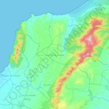
معتمدية تاكلسة topographic map
Interactive map
Click on the map to display elevation.
About this map
Name: معتمدية تاكلسة topographic map, elevation, terrain.
Location: معتمدية تاكلسة, Nabeul, 8031, Tunisia (36.67612 10.58290 36.91033 10.80885)
Average elevation: 103 m
Minimum elevation: -1 m
Maximum elevation: 627 m