Geolocate

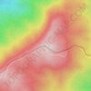
Kachin State topographic map

Click on the map to display elevation.

About this map

Name: Kachin State topographic map, elevation, terrain.

Location: Kachin State, Myanmar (23.63325 95.80617 28.54784 98.78221)

Average elevation: 1,487 m

Minimum elevation: 82 m

Maximum elevation: 6,429 m

Other topographic maps

Click on a map to view its topography, its elevation and its terrain.
Dawei

Myanmar > Tanintharyi Region > Dawei Township

Average elevation: 52 m

Mrauk U

Myanmar > Rakhine > Mrauk-U Township

Average elevation: 8 m

Kalaw

Myanmar > Shan State > Kalaw Township

The hill station is located at an elevation of 1310 metres, 50 km from the Inle lake. Kalaw is famous for hiking and trekking. Many trekking trails ranging from nearby places to Inle Lake and Pindaya. The town still feels like a high-altitude holiday resort – the air is cool, the atmosphere is calm and the…

Average elevation: 1,348 m
Labutta

Myanmar > Ayeyarwady > Labutta

Average elevation: 4 m

Okkan

Myanmar > Yangon > Taikkyi Township

Average elevation: 17 m

Yan Aung May

Myanmar > Shan State > Lashio

Average elevation: 822 m

Inntakaw

Myanmar > Bago Region > Bago Township

Average elevation: 13 m

Zinchaung

Myanmar > Mandalay > Thabeikkyin Township

Average elevation: 107 m

Doi Lang

Myanmar > Shan State > Mong Hsat District

Average elevation: 1,853 m

Sin Phyu Kyun

Myanmar > Magway

Average elevation: 52 m

Gear up for your next adventure:

🔭Outdoor Binoculars - Lightweight binoculars for birdwatching and hiking
🧥Fleece Jacket - Warm and lightweight jacket for layering
💡LED Headlamp - Hands-free illumination for night hiking and camping
🔪Outdoor Multitool - Versatile tool for repairs and food prep in the wild
🥾Hiking Leggings - Comfortable leggings for outdoor activities

As an Amazon Associate, this site earns from qualifying purchases at no extra cost to you.