Geolocate

Sottoguda topographic map

Click on the map to display elevation.

About this map
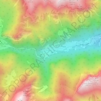
Name: Sottoguda topographic map, elevation, terrain.

Location: Sottoguda, Rocca Pietore, Belluno, Veneto, 32023, Italy (46.40499 11.91802 46.44499 11.95802)

Average elevation: 1,745 m

Minimum elevation: 1,140 m

Maximum elevation: 2,382 m

Gear up for your next adventure:

🥾Durable Hiking Shoes - Long-lasting shoes for frequent hiking
🏕️Camping Hammock - Integrated protection for sleeping between trees
🧢Sun Protection Cap - Breathable cap to protect from sun exposure
🧭GPS Outdoor Watch - Smart watch for navigation and fitness tracking in nature
🧦Outdoor Socks - Durable socks designed for hiking and outdoor sports

As an Amazon Associate, this site earns from qualifying purchases at no extra cost to you.