
Thank you for supporting this site ❤️
Make a donation
Make a donation
Gear up for your next adventure:
As an Amazon Associate, this site earns from qualifying purchases at no extra cost to you.
Cariñena topographic map
Click on the map to display elevation.
Thank you for supporting this site ❤️
Make a donation
Make a donation
Gear up for your next adventure:
As an Amazon Associate, this site earns from qualifying purchases at no extra cost to you.
About this map
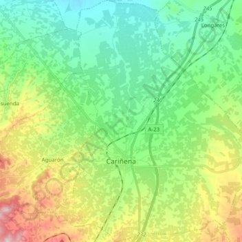
Name: Cariñena topographic map, elevation, terrain.
Location: Cariñena, Campo de Cariñena, Zaragoza, Aragon, 50400, Spain (41.29981 -1.26895 41.41447 -1.14463)
Average elevation: 605 m
Minimum elevation: 473 m
Maximum elevation: 901 m
Thank you for supporting this site ❤️
Make a donation
Make a donation
Gear up for your next adventure:
As an Amazon Associate, this site earns from qualifying purchases at no extra cost to you.