Geolocate

Fotherby topographic map

Click on the map to display elevation.

About this map

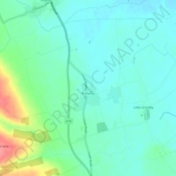
Name: Fotherby topographic map, elevation, terrain.

Location: Fotherby, East Lindsey, Lincolnshire, England, United Kingdom (53.39498 -0.05910 53.41807 -0.00987)

Average elevation: 35 m

Minimum elevation: 14 m

Maximum elevation: 99 m

Other topographic maps

Click on a map to view its topography, its elevation and its terrain.

Gear up for your next adventure:

🧴Insect Repellent - Protect yourself from bugs during outdoor adventures
🔨Vehicle Emergency Tool - Safety tool for remote road trips to trailheads
🚲Handlebar Phone Mount - View topographic-map.com live while cycling
🧤Insulated Winter Gloves - Heavy-duty protection for sub-zero Canadian adventures
🧥Insulated Jacket - Keep warm in cold outdoor conditions

As an Amazon Associate, this site earns from qualifying purchases at no extra cost to you.