Geolocate

Westgate topographic map

Click on the map to display elevation.

About this map

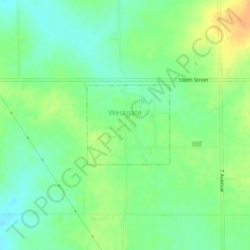
Name: Westgate topographic map, elevation, terrain.

Location: Westgate, Fayette County, Iowa, United States (42.76406 -92.00195 42.77266 -91.98970)

Average elevation: 333 m

Minimum elevation: 319 m

Maximum elevation: 352 m

Gear up for your next adventure:

🧥Waterproof Pants - Keep dry during rainy hiking conditions
🥾Trail Running Shoes - Lightweight and durable shoes for trail running
🥾Waterproof Hiking Boots - Essential footwear for rugged terrain and wet Canadian trails
🥽Outdoor Goggles - Protective eyewear for outdoor activities
🧢Outdoor Visor - Breathable visor for sunny hikes

As an Amazon Associate, this site earns from qualifying purchases at no extra cost to you.