Geolocate

Pichari topographic map

Click on the map to display elevation.

About this map

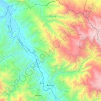
Name: Pichari topographic map, elevation, terrain.

Location: Pichari, Province of La Convención, Cusco, Peru (-12.57527 -73.98110 -12.22012 -73.64448)

Average elevation: 1,625 m

Minimum elevation: 458 m

Maximum elevation: 4,036 m

Other topographic maps

Click on a map to view its topography, its elevation and its terrain.

Choquepata

Peru > Cusco > Vilcabamba

Average elevation: 3,859 m

Gear up for your next adventure:

🧦Hiking Liner Socks - Thin base layer to prevent friction and blisters
🛶Canoe Life Vest - Safety vest for water sports
🛶Waterproof Dry Bags - Keep electronics and clothes dry during river crossings
🪑Insulated Seat Pad - Protect your seat from cold rocks and wet logs
🥾Light Hiking Boots - Lightweight and comfortable boots for day hikes

As an Amazon Associate, this site earns from qualifying purchases at no extra cost to you.