Brocken topographic map
Click on the map to display elevation.
Brocken
The Brocken (German pronunciation: [ˈbʁɔkn̩] ), also sometimes referred to as the Blocksberg, is a 1,141 m (3,743 ft) mountain near Schierke in the German state of Saxony-Anhalt, between the rivers Weser and Elbe. The highest peak in the Harz mountain range, and in Northern Germany, it is subalpine, yet has a microclimate resembling that of mountains nearly 1,000 m (3,300 ft) higher. The elevation above its tree line tends to have snowcover from September to May, and mists and fogs shroud it up to 300 days a year. The mean annual temperature is only 2.9 °C (37.2 °F). It is the easternmost mountain in northern Germany; the next prominent elevation directly to its east would be in the Ural Mountains in Russia.
About this map
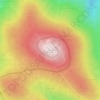
Name: Brocken topographic map, elevation, terrain.
Location: Brocken, Wernigerode, Landkreis Harz, Saxony-Anhalt, Germany (51.79908 10.61559 51.79918 10.61569)
Average elevation: 963 m
Minimum elevation: 701 m
Maximum elevation: 1,142 m
Other topographic maps
Click on a map to view its topography, its elevation and its terrain.