Geolocate

01844 topographic map

Click on the map to display elevation.

About this map

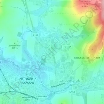
Name: 01844 topographic map, elevation, terrain.

Location: 01844, Langburkersdorf, Neustadt in Sachsen, Saxony, Germany (51.03238 14.22406 51.03248 14.22416)

Average elevation: 356 m

Minimum elevation: 322 m

Maximum elevation: 472 m

Gear up for your next adventure:

🔦LED Headtorch - Bright and durable light for night activities
🔭Compact Binoculars - Lightweight optics for scouting trails and wildlife
🌡️Emergency Mylar Blankets - Compact thermal protection for unexpected nights outdoors
🧦Merino Wool Socks - Moisture-wicking comfort for long-distance hiking
🧥Fleece Jacket - Warm and lightweight jacket for layering

As an Amazon Associate, this site earns from qualifying purchases at no extra cost to you.