
Thank you for supporting this site ❤️
Make a donation
Make a donation
Gear up for your next adventure:
As an Amazon Associate, this site earns from qualifying purchases at no extra cost to you.
Fonds-Saint-Denis topographic map
Click on the map to display elevation.
Thank you for supporting this site ❤️
Make a donation
Make a donation
Gear up for your next adventure:
As an Amazon Associate, this site earns from qualifying purchases at no extra cost to you.
About this map
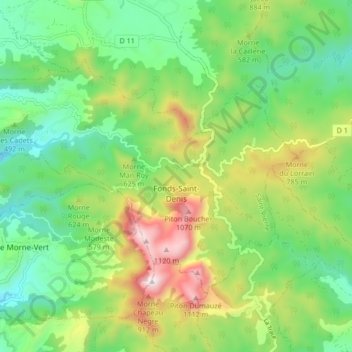
Name: Fonds-Saint-Denis topographic map, elevation, terrain.
Location: Fonds-Saint-Denis, Saint-Pierre, Martinique, 97250, France (14.69560 -61.16254 14.74978 -61.07872)
Average elevation: 498 m
Minimum elevation: 146 m
Maximum elevation: 1,164 m
Thank you for supporting this site ❤️
Make a donation
Make a donation
Gear up for your next adventure:
As an Amazon Associate, this site earns from qualifying purchases at no extra cost to you.