Geolocate

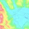
Morton topographic map

Click on the map to display elevation.

About this map

Name: Morton topographic map, elevation, terrain.

Location: Morton, Lewis County, Washington, United States (46.55011 -122.30137 46.56922 -122.26288)

Average elevation: 328 m

Minimum elevation: 265 m

Maximum elevation: 671 m

Other topographic maps

Click on a map to view its topography, its elevation and its terrain.
Cinebar

United States > Washington > Lewis County

Average elevation: 308 m

Randle

United States > Washington > Lewis County

Average elevation: 378 m

The Rockies

United States > Washington > Lewis County

Average elevation: 1,012 m

Silver Falls

United States > Washington > Lewis County

Average elevation: 847 m

Angry Mountain

United States > Washington > Lewis County

Average elevation: 1,401 m

Onalaska

United States > Washington > Lewis County

Average elevation: 170 m

Packwood

United States > Washington > Lewis County

Average elevation: 379 m

Adna

United States > Washington > Lewis County

Average elevation: 82 m

Mayfield

United States > Washington > Lewis County

Average elevation: 223 m

Bunker

United States > Washington > Lewis County

Average elevation: 101 m

Randle

United States > Washington > Lewis County

Average elevation: 378 m

Ceres

United States > Washington > Lewis County

Average elevation: 123 m

Glenoma

United States > Washington > Lewis County

Average elevation: 354 m

Gear up for your next adventure:

🔭Compact Monocular - One-handed bird watching and trail spotting
🌬️Windproof Camp Stove - Efficient cooking even on exposed mountain peaks
🧥Thermal Fleece Jacket - Versatile insulation for changing mountain temperatures
🧥Insulated Jacket - Keep warm in cold outdoor conditions
🧶550 Survival Paracord - Versatile utility cord for emergency repairs and rigging

As an Amazon Associate, this site earns from qualifying purchases at no extra cost to you.