Geolocate

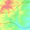
Chinchón topographic map

Click on the map to display elevation.

Chinchón

It has an irregular shape in plan with a simple and orderly structure in elevation. The buildings have three floors, with lintelled galleries and 234 wooden balconies called claros, supported by upright wooden pillars.

Wikipedia (CC-BY-SA 3.0)

About this map

Name: Chinchón topographic map, elevation, terrain.

Location: Chinchón, Community of Madrid, 28370, Spain (40.09945 -3.58090 40.21854 -3.38544)

Average elevation: 666 m

Minimum elevation: 511 m

Maximum elevation: 789 m

Other topographic maps

Click on a map to view its topography, its elevation and its terrain.
Madrid

Spain > Community of Madrid > Madrid

Average elevation: 650 m

Fuente Pila

Spain > Community of Madrid > Navalcarnero

Average elevation: 631 m

Eurovillas

Spain > Community of Madrid > Eurovillas

Average elevation: 826 m

Gear up for your next adventure:

🧤Thermal Hiking Gloves - Grip-enhanced gloves for cold-weather altitude trekking
🧦Outdoor Socks - Durable socks designed for hiking and outdoor sports
🥾Waterproof Trail Shoes - Shoes designed to handle wet terrain
🛰️Satellite Messenger - Emergency communication for areas with no cell service
🔋Lithium AA Batteries - Long-lasting power that performs in extreme cold

As an Amazon Associate, this site earns from qualifying purchases at no extra cost to you.