Geolocate

Val-de-Ruz topographic map

Click on the map to display elevation.

About this map

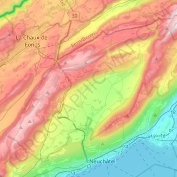
Name: Val-de-Ruz topographic map, elevation, terrain.

Location: Val-de-Ruz, Neuchâtel, Switzerland (46.98898 6.79541 47.12731 7.03996)

Average elevation: 923 m

Minimum elevation: 422 m

Maximum elevation: 1,510 m

Gear up for your next adventure:

📷Outdoor Action Camera - Capture high-elevation views and rugged adventures
💡LED Headlamp - Hands-free illumination for night hiking and camping
🥾Trekking Poles - Adjustable trekking poles to reduce knee stress and improve stability
Backpacking Tent - Lightweight tent for long-distance hiking trips
Camping Groundsheet - Protect your tent from moisture and dirt

As an Amazon Associate, this site earns from qualifying purchases at no extra cost to you.