Geolocate

Kiagot topographic map

Click on the map to display elevation.

About this map

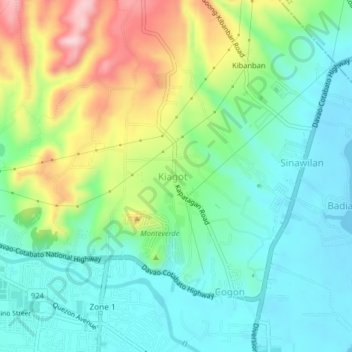
Name: Kiagot topographic map, elevation, terrain.

Location: Kiagot, Digos, Davao del Sur, Davao Region, 8002, Philippines (6.75300 125.34418 6.79300 125.38418)

Average elevation: 74 m

Minimum elevation: 0 m

Maximum elevation: 232 m

Gear up for your next adventure:

🏃Hydration Running Vest - Carry water and maps close to your body for speed
🧴Insect Repellent - Protect yourself from bugs during outdoor adventures
🚲Bike Repair Kit - Essential tools for on-trail mechanical issues
🧥Thermal Fleece Jacket - Versatile insulation for changing mountain temperatures
🚲MTB Frame Bag - Carry tools and maps directly on your bicycle frame

As an Amazon Associate, this site earns from qualifying purchases at no extra cost to you.