
Thank you for supporting this site ❤️
Make a donation
Make a donation
Gear up for your next adventure:
As an Amazon Associate, this site earns from qualifying purchases at no extra cost to you.
Hohegeiß topographic map
Click on the map to display elevation.
Thank you for supporting this site ❤️
Make a donation
Make a donation
Gear up for your next adventure:
As an Amazon Associate, this site earns from qualifying purchases at no extra cost to you.
About this map
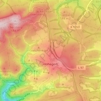
Name: Hohegeiß topographic map, elevation, terrain.
Location: Hohegeiß, Braunlage, Landkreis Goslar, Lower Saxony, Germany (51.65043 10.64002 51.68791 10.68399)
Average elevation: 568 m
Minimum elevation: 394 m
Maximum elevation: 679 m
Thank you for supporting this site ❤️
Make a donation
Make a donation
Gear up for your next adventure:
As an Amazon Associate, this site earns from qualifying purchases at no extra cost to you.