Geolocate

Tupungato topographic map

Click on the map to display elevation.

About this map

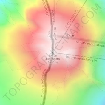
Name: Tupungato topographic map, elevation, terrain.

Location: Tupungato, San José de Maipo, Provincia de Cordillera, Santiago Metropolitan Region, Chile (-33.35844 -69.77043 -33.35834 -69.77033)

Average elevation: 6,002 m

Minimum elevation: 5,189 m

Maximum elevation: 6,573 m

Gear up for your next adventure:

🔭Compact Binoculars - Lightweight optics for scouting trails and wildlife
🏃Hydration Running Vest - Carry water and maps close to your body for speed
Lightweight Backpacking Tent - Compact tent for efficient hiking trips
🧴Outdoor Sunscreen - High SPF protection for high-altitude UV exposure
🧥Thermal Layer - Insulating layer for cold outdoor conditions

As an Amazon Associate, this site earns from qualifying purchases at no extra cost to you.