Geolocate

Teton Village topographic map

Click on the map to display elevation.

About this map

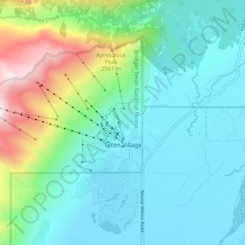
Name: Teton Village topographic map, elevation, terrain.

Location: Teton Village, Teton County, Wyoming, 83025, United States (43.57385 -110.87976 43.61177 -110.80548)

Average elevation: 2,323 m

Minimum elevation: 1,906 m

Maximum elevation: 3,179 m

Gear up for your next adventure:

🛁Quick-Dry Microfiber Towel - Space-saving towel that dries rapidly on the move
🪑Ultralight Camping Stool - Compact seating for rest stops during long hikes
🧥Thermal Fleece Jacket - Versatile insulation for changing mountain temperatures
🛏️Camping Sleeping Mat - Comfortable mats for sleeping outdoors
🧭GPS Tracker - Track your location in remote areas safely

As an Amazon Associate, this site earns from qualifying purchases at no extra cost to you.