
Niles topographic map
Click on the map to display elevation.
About this map
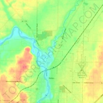
Name: Niles topographic map, elevation, terrain.
Location: Niles, Berrien County, Michigan, 49120, United States (41.81230 -86.28337 41.88439 -86.19921)
Average elevation: 222 m
Minimum elevation: 192 m
Maximum elevation: 258 m
Other topographic maps
Click on a map to view its topography, its elevation and its terrain.
Grand Mere State Park
United States > Michigan > Berrien County > Lincoln Charter Township
Average elevation: 185 m
Grand Mere State Park
United States > Michigan > Berrien County > Lincoln Charter Township
Average elevation: 185 m
Grand Mere State Park
United States > Michigan > Berrien County > Stevensville
Average elevation: 185 m
Grand Mere State Park
United States > Michigan > Berrien County > Stevensville
Average elevation: 185 m