Geolocate

Prenzlau topographic map

Click on the map to display elevation.

About this map
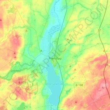
Name: Prenzlau topographic map, elevation, terrain.

Location: Prenzlau, Uckermark, Brandenburg, 17291, Germany (53.24140 13.75539 53.40144 13.96256)

Average elevation: 48 m

Minimum elevation: 13 m

Maximum elevation: 102 m

Other topographic maps

Click on a map to view its topography, its elevation and its terrain.

Angermünde

Germany > Brandenburg > Uckermark > Angermünde > Angermünde

Average elevation: 54 m

Vierraden

Germany > Brandenburg > Uckermark > Schwedt/Oder

Average elevation: 6 m

Gear up for your next adventure:

📷Outdoor Action Camera - Capture high-elevation views and rugged adventures
🎒Hiking Daypack - Lightweight and durable backpacks for day trips and excursions
🥫Freeze-Dried Meals - Lightweight, high-calorie nutrition for multi-day treks
🧥Waterproof Pants - Keep dry during rainy hiking conditions
🎒Fully Waterproof Backpack - Total protection for photography gear and electronics

As an Amazon Associate, this site earns from qualifying purchases at no extra cost to you.