Geolocate

Sandusky topographic map

Click on the map to display elevation.

About this map

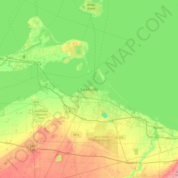
Name: Sandusky topographic map, elevation, terrain.

Location: Sandusky, Erie County, Ohio, 44870, United States (41.29610 -82.87158 41.61610 -82.55158)

Average elevation: 184 m

Minimum elevation: 146 m

Maximum elevation: 248 m

Gear up for your next adventure:

🥾Mountain Trail Shoes - High-traction shoes for mountain trails
🏕️Camping Hammock - Integrated protection for sleeping between trees
🛁Quick-Dry Microfiber Towel - Space-saving towel that dries rapidly on the move
🥾Trail Hiking Shoes - Durable shoes designed for rugged trails
🐕Hiking Dog Pack - Let your canine companion carry their own water and food

As an Amazon Associate, this site earns from qualifying purchases at no extra cost to you.