Geolocate

Samobor topographic map

Click on the map to display elevation.

About this map

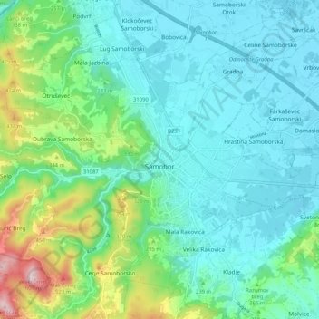
Name: Samobor topographic map, elevation, terrain.

Location: Samobor, Grad Samobor, Zagreb County, Croatia (45.78078 15.65733 45.82596 15.75969)

Average elevation: 224 m

Minimum elevation: 124 m

Maximum elevation: 590 m

Other topographic maps

Click on a map to view its topography, its elevation and its terrain.

Zaprešić

Croatia > Zagreb County > Zaprešić

Average elevation: 162 m

Gear up for your next adventure:

🥾Hiking Leggings - Comfortable leggings for outdoor activities
🧢Outdoor Cap - Protective cap for sun and rain during hikes
🧥Thermal Fleece Jacket - Versatile insulation for changing mountain temperatures
Camping Coffee Maker - Brew fresh coffee anywhere on the topographic map
🎒Hiking Daypack - Lightweight and durable backpacks for day trips and excursions

As an Amazon Associate, this site earns from qualifying purchases at no extra cost to you.