Geolocate

Mountain Park topographic map

Click on the map to display elevation.

About this map

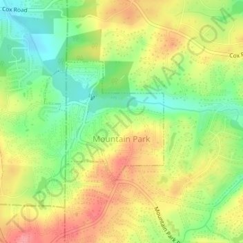
Name: Mountain Park topographic map, elevation, terrain.

Location: Mountain Park, Fulton County, Georgia, United States (34.07622 -84.42166 34.08953 -84.40564)

Average elevation: 312 m

Minimum elevation: 267 m

Maximum elevation: 358 m

Gear up for your next adventure:

🔥Camping Stove - Portable stoves to cook outdoors with ease
🚲Heavy Duty Bike Lock - Secure your bike at the trailhead or during stops
🧳Compression Sacks - Maximize space in your backpack by shrinking gear
🔦LED Headtorch - Bright and durable light for night activities
🕶️Polarized Sunglasses - Protect your eyes with durable polarized lenses

As an Amazon Associate, this site earns from qualifying purchases at no extra cost to you.