
Thank you for supporting this site ❤️
Make a donation
Make a donation
Gear up for your next adventure:
As an Amazon Associate, this site earns from qualifying purchases at no extra cost to you.
Molenberg topographic map
Click on the map to display elevation.
Thank you for supporting this site ❤️
Make a donation
Make a donation
Gear up for your next adventure:
As an Amazon Associate, this site earns from qualifying purchases at no extra cost to you.
About this map
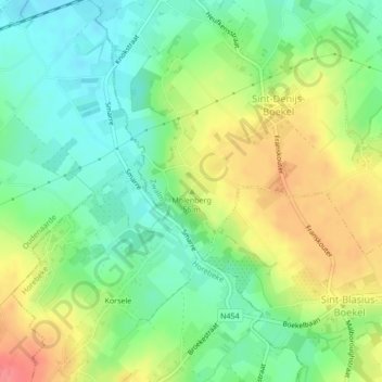
Name: Molenberg topographic map, elevation, terrain.
Location: Molenberg, Zwalm, Oudenaarde, East Flanders, 9636, Belgium (50.85956 3.70291 50.85966 3.70301)
Average elevation: 43 m
Minimum elevation: 14 m
Maximum elevation: 84 m
Thank you for supporting this site ❤️
Make a donation
Make a donation
Gear up for your next adventure:
As an Amazon Associate, this site earns from qualifying purchases at no extra cost to you.