
Make a donation
Gear up for your next adventure:
As an Amazon Associate, this site earns from qualifying purchases at no extra cost to you.
Whidbey Island topographic map
Click on the map to display elevation.
Make a donation
Gear up for your next adventure:
As an Amazon Associate, this site earns from qualifying purchases at no extra cost to you.
Whidbey Island
Whidbey Island lies partially in the rain shadow of the Olympic Mountain Range to the west, and has a variety of climate zones. This can be observed by rainfall amounts – wettest in the south with average rainfall of 36 inches (910 mm), driest in the central district of Coupeville with average rainfall of 20 to 22 inches (510 to 560 mm), and turning moister again farther north with average rainfall of 32 inches (810 mm). Microclimates abound, determined by proximity to water, elevation and prevailing winds.
Make a donation
Gear up for your next adventure:
As an Amazon Associate, this site earns from qualifying purchases at no extra cost to you.
About this map
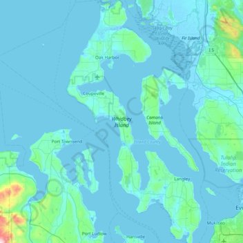
Name: Whidbey Island topographic map, elevation, terrain.
Location: Whidbey Island, Island County, Washington, United States (47.90492 -122.76999 48.41132 -122.34936)
Average elevation: 45 m
Minimum elevation: -4 m
Maximum elevation: 993 m
Make a donation
Gear up for your next adventure:
As an Amazon Associate, this site earns from qualifying purchases at no extra cost to you.
Other topographic maps
Click on a map to view its topography, its elevation and its terrain.