

Rodez topographic map
Click on the map to display elevation.
Rodez
Rodez's climate, a supra-Mediterranean level, is a Mediterranean climate (Csb), and is colder compared to other cities in the south of France. Winters are sharp and summers often very hot and sunny. During winter, Rodez has occasional snowfall due to its low altitude of 550 metres (1,800 ft) in contrast to other towns in the north of the department closer to the higher Aubrac plateau.
About this map
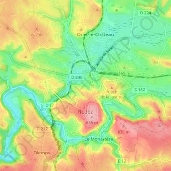
Name: Rodez topographic map, elevation, terrain.
Location: Rodez, Aveyron, Occitania, Metropolitan France, 12000, France (44.34053 2.53335 44.37763 2.60642)
Average elevation: 567 m
Minimum elevation: 502 m
Maximum elevation: 646 m