
Thank you for supporting this site ❤️
Make a donation
Make a donation
Gear up for your next adventure:
As an Amazon Associate, this site earns from qualifying purchases at no extra cost to you.
Sumbal topographic map
Click on the map to display elevation.
Thank you for supporting this site ❤️
Make a donation
Make a donation
Gear up for your next adventure:
As an Amazon Associate, this site earns from qualifying purchases at no extra cost to you.
About this map
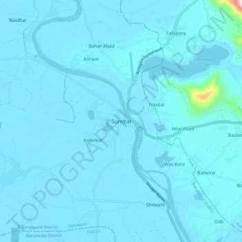
Name: Sumbal topographic map, elevation, terrain.
Location: Sumbal, Sonawari, Bandipore District, Jammu and Kashmir, India (34.19104 74.60477 34.27104 74.68477)
Average elevation: 1,594 m
Minimum elevation: 1,575 m
Maximum elevation: 2,090 m
Thank you for supporting this site ❤️
Make a donation
Make a donation
Gear up for your next adventure:
As an Amazon Associate, this site earns from qualifying purchases at no extra cost to you.