Geolocate

Tsemgön topographic map

Click on the map to display elevation.

About this map

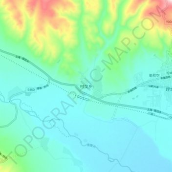
Name: Tsemgön topographic map, elevation, terrain.

Location: Tsemgön, Litang County, Kardze, Sichuan, China (29.94878 100.17739 30.02878 100.25739)

Average elevation: 4,006 m

Minimum elevation: 3,895 m

Maximum elevation: 4,432 m

Other topographic maps

Click on a map to view its topography, its elevation and its terrain.

Mawa

China > Sichuan > Litang County

Average elevation: 3,977 m

Gear up for your next adventure:

🥾Waterproof Hiking Boots - Boots keeping your feet dry in wet conditions
🧦Outdoor Socks - Durable socks designed for hiking and outdoor sports
🧤Thermal Hiking Gloves - Grip-enhanced gloves for cold-weather altitude trekking
🥾Mountain Hiking Boots - High-traction boots for rocky terrain
🚲MTB Frame Bag - Carry tools and maps directly on your bicycle frame

As an Amazon Associate, this site earns from qualifying purchases at no extra cost to you.