Geolocate

Lyness topographic map

Click on the map to display elevation.

About this map

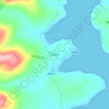
Name: Lyness topographic map, elevation, terrain.

Location: Lyness, Orkney Islands, Scotland, KW16 3NT, United Kingdom (58.81289 -3.22707 58.85289 -3.18707)

Average elevation: 28 m

Minimum elevation: 0 m

Maximum elevation: 165 m

Other topographic maps

Click on a map to view its topography, its elevation and its terrain.

Burray

United Kingdom > Scotland > Orkney Islands

Average elevation: 7 m

Gear up for your next adventure:

🥾Waterproof Hiking Shoes - Durable shoes for wet and rugged trails
🛏️Camping Sleeping Mat - Comfortable mats for sleeping outdoors
Camping Coffee Maker - Brew fresh coffee anywhere on the topographic map
🥾Hiking Shoes - Durable and comfortable shoes for trail hiking
🧊Portable Cooler - Keep food and drinks cold during outdoor adventures

As an Amazon Associate, this site earns from qualifying purchases at no extra cost to you.