
Thank you for supporting this site ❤️
Make a donation
Make a donation
Gear up for your next adventure:
As an Amazon Associate, this site earns from qualifying purchases at no extra cost to you.
Wehrheim topographic map
Click on the map to display elevation.
Thank you for supporting this site ❤️
Make a donation
Make a donation
Gear up for your next adventure:
As an Amazon Associate, this site earns from qualifying purchases at no extra cost to you.
About this map
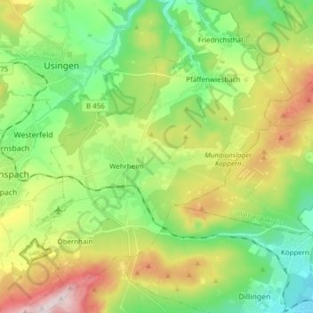
Name: Wehrheim topographic map, elevation, terrain.
Location: Wehrheim, Hochtaunuskreis, Hesse, 61273, Germany (50.25669 8.52092 50.35456 8.65035)
Average elevation: 346 m
Minimum elevation: 184 m
Maximum elevation: 636 m
Thank you for supporting this site ❤️
Make a donation
Make a donation
Gear up for your next adventure:
As an Amazon Associate, this site earns from qualifying purchases at no extra cost to you.