
Thank you for supporting this site ❤️
Make a donation
Make a donation
Gear up for your next adventure:
As an Amazon Associate, this site earns from qualifying purchases at no extra cost to you.
Wildberg topographic map
Click on the map to display elevation.
Thank you for supporting this site ❤️
Make a donation
Make a donation
Gear up for your next adventure:
As an Amazon Associate, this site earns from qualifying purchases at no extra cost to you.
About this map
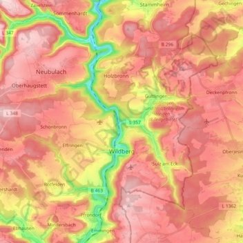
Name: Wildberg topographic map, elevation, terrain.
Location: Wildberg, Landkreis Calw, Baden-Württemberg, 72218, Germany (48.59415 8.63906 48.68006 8.81946)
Average elevation: 532 m
Minimum elevation: 340 m
Maximum elevation: 642 m
Thank you for supporting this site ❤️
Make a donation
Make a donation
Gear up for your next adventure:
As an Amazon Associate, this site earns from qualifying purchases at no extra cost to you.