Geolocate

Port Klang topographic map

Click on the map to display elevation.

About this map

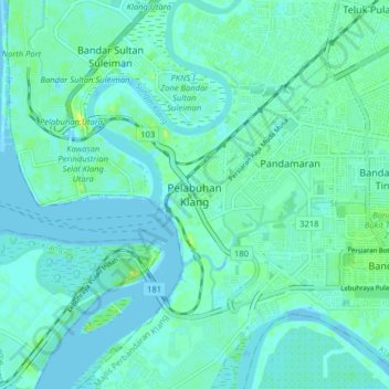
Name: Port Klang topographic map, elevation, terrain.

Location: Port Klang, Klang, Selangor, 42009, Malaysia (2.96276 101.35667 3.04276 101.43667)

Average elevation: 4 m

Minimum elevation: -4 m

Maximum elevation: 15 m

Gear up for your next adventure:

🧤Rechargeable Heated Gloves - Extreme warmth for Canadian winter expeditions
🧰Emergency Multi-Tool - Compact multi-tool for outdoor survival
🧼Biodegradable Camp Soap - Environmentally friendly cleaning for gear and body
🦌Outdoor Trail Camera - Monitor wildlife activity near your favorite spots
🥾Trail Hiking Socks - Comfortable socks to prevent blisters and fatigue

As an Amazon Associate, this site earns from qualifying purchases at no extra cost to you.