Geolocate

Chester topographic map

Click on the map to display elevation.

About this map

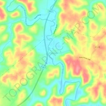
Name: Chester topographic map, elevation, terrain.

Location: Chester, Meigs County, Ohio, 45720, United States (39.06758 -81.94264 39.10758 -81.90264)

Average elevation: 221 m

Minimum elevation: 180 m

Maximum elevation: 270 m

Gear up for your next adventure:

🌡️Emergency Mylar Blankets - Compact thermal protection for unexpected nights outdoors
🔪Outdoor Multitool - Versatile tool for repairs and food prep in the wild
💡LED Headlamp - Hands-free illumination for night hiking and camping
🥾Hiking Boots - Sturdy boots providing ankle support and traction on rugged trails
🧥Waterproof Hiking Jacket - Protect yourself from rain and wind while hiking

As an Amazon Associate, this site earns from qualifying purchases at no extra cost to you.