Geolocate

Midhurst topographic map

Click on the map to display elevation.

About this map
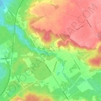
Name: Midhurst topographic map, elevation, terrain.

Location: Midhurst, Springwater, Simcoe County, Central Ontario, Ontario, L9X 0P1, Canada (44.42759 -79.75362 44.46759 -79.71362)

Average elevation: 255 m

Minimum elevation: 202 m

Maximum elevation: 300 m

Simcoe County trails, hiking, mountain biking, running and outdoor activities

Other topographic maps

Click on a map to view its topography, its elevation and its terrain.
Gear up for your next adventure:

🥾Hiking Shorts - Breathable shorts suitable for summer hikes
📷Outdoor Action Camera - Capture high-elevation views and rugged adventures
🧥Thermal Layer - Insulating layer for cold outdoor conditions
🩹Compact First Aid Kit - Pre-packed essentials for common trail injuries
🧭GPS Tracker - Track your location in remote areas safely

As an Amazon Associate, this site earns from qualifying purchases at no extra cost to you.