
Devi Dhura topographic map
Click on the map to display elevation.
About this map
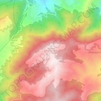
Name: Devi Dhura topographic map, elevation, terrain.
Location: Devi Dhura, Pati, Champawat, Uttarakhand, 263627, India (29.39315 79.84511 29.43315 79.88511)
Average elevation: 1,731 m
Minimum elevation: 1,239 m
Maximum elevation: 2,043 m