Geolocate

Polverara topographic map

Click on the map to display elevation.

About this map
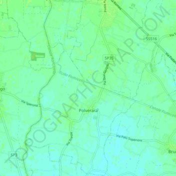
Name: Polverara topographic map, elevation, terrain.

Location: Polverara, Province of Padua, Veneto, 35020, Italy (45.28892 11.92814 45.34393 11.97714)

Average elevation: 5 m

Minimum elevation: 1 m

Maximum elevation: 9 m

Gear up for your next adventure:

🧥Softshell Jacket - Windproof and breathable jacket for hiking
🧥Thermal Layer - Insulating layer for cold outdoor conditions
🧴Bear Spray Holster - Quick-access carry for essential Canadian wilderness safety
🧣Merino Neck Gaiter - Protects against wind, sun, and cold at high altitudes
🩹Moleskin Blister Pads - Direct protection for painful foot pressure points

As an Amazon Associate, this site earns from qualifying purchases at no extra cost to you.