Geolocate

Wichita Falls topographic map

Click on the map to display elevation.

About this map

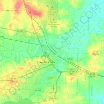
Name: Wichita Falls topographic map, elevation, terrain.

Location: Wichita Falls, Wichita County, Texas, United States (33.83565 -98.61439 33.99641 -98.42435)

Average elevation: 300 m

Minimum elevation: 279 m

Maximum elevation: 336 m

Other topographic maps

Click on a map to view its topography, its elevation and its terrain.

Lucy Park

United States > Texas > Wichita County > Wichita Falls

Average elevation: 293 m

Electra

United States > Texas > Wichita County > Electra > Electra

Average elevation: 358 m

Gear up for your next adventure:

🥾Trail Hiking Socks - Comfortable socks to prevent blisters and fatigue
🔋Emergency Crank Radio - Weather alerts and power without needing batteries
🧶550 Survival Paracord - Versatile utility cord for emergency repairs and rigging
🔭Compact Binoculars - Lightweight optics for scouting trails and wildlife
Family Camping Tent - Spacious tent suitable for family camping trips

As an Amazon Associate, this site earns from qualifying purchases at no extra cost to you.