Geolocate

Wattens topographic map

Click on the map to display elevation.

About this map

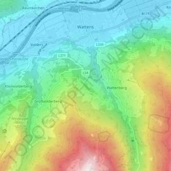
Name: Wattens topographic map, elevation, terrain.

Location: Wattens, Bezirk Innsbruck-Land, Tyrol, 6112, Austria (47.24255 11.57772 47.30307 11.61860)

Average elevation: 1,040 m

Minimum elevation: 544 m

Maximum elevation: 2,170 m

Gear up for your next adventure:

🔦LED Headtorch - Bright and durable light for night activities
🕶️Polarized Sunglasses - Protect your eyes with durable polarized lenses
🕯️Camping Lantern - Illuminates your entire campsite with high-efficiency LEDs
🩹Moleskin Blister Pads - Direct protection for painful foot pressure points
🪑Ultralight Camping Stool - Compact seating for rest stops during long hikes

As an Amazon Associate, this site earns from qualifying purchases at no extra cost to you.