Geolocate

Неман topographic map

Click on the map to display elevation.

About this map
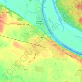
Name: Неман topographic map, elevation, terrain.

Location: Неман, Nemansky District, Kaliningrad, Northwestern Federal District, Russia (55.00852 21.99228 55.05892 22.08532)

Average elevation: 22 m

Minimum elevation: -1 m

Maximum elevation: 47 m

Other topographic maps

Click on a map to view its topography, its elevation and its terrain.
Gear up for your next adventure:

🕶️Polarized Sunglasses - Reduces glare from snow and water at high elevations
🧰Emergency Multi-Tool - Compact multi-tool for outdoor survival
🛌Insulated Sleeping Pad - Critical thermal barrier between you and the cold ground
🥫Freeze-Dried Meals - Lightweight, high-calorie nutrition for multi-day treks
🦯Trekking Poles - Reduced impact on joints for steep topographic climbs

As an Amazon Associate, this site earns from qualifying purchases at no extra cost to you.