
Altoona topographic map
Click on the map to display elevation.
About this map
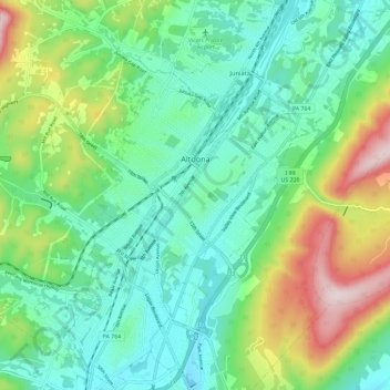
Name: Altoona topographic map, elevation, terrain.
Location: Altoona, Blair County, Pennsylvania, United States (40.46615 -78.43298 40.55479 -78.36470)
Average elevation: 443 m
Minimum elevation: 307 m
Maximum elevation: 780 m
Other topographic maps
Click on a map to view its topography, its elevation and its terrain.
Plain Nine Dam
United States > Pennsylvania > Blair County > Juniata Township
Average elevation: 550 m
Mill Run
United States > Pennsylvania > Blair County > Altoona > Allegheny Furnace
Average elevation: 349 m