
Thank you for supporting this site ❤️
Make a donation
Make a donation
Gear up for your next adventure:
As an Amazon Associate, this site earns from qualifying purchases at no extra cost to you.
Zoutleeuw topographic map
Click on the map to display elevation.
Thank you for supporting this site ❤️
Make a donation
Make a donation
Gear up for your next adventure:
As an Amazon Associate, this site earns from qualifying purchases at no extra cost to you.
About this map
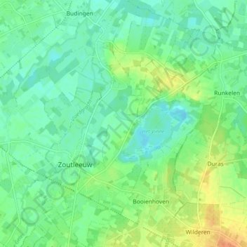
Name: Zoutleeuw topographic map, elevation, terrain.
Location: Zoutleeuw, Leuven, Flemish Brabant, Flanders, Belgium (50.81645 5.09023 50.86658 5.14880)
Average elevation: 33 m
Minimum elevation: 20 m
Maximum elevation: 58 m
Thank you for supporting this site ❤️
Make a donation
Make a donation
Gear up for your next adventure:
As an Amazon Associate, this site earns from qualifying purchases at no extra cost to you.