
Thank you for supporting this site ❤️
Make a donation
Make a donation
Gear up for your next adventure:
As an Amazon Associate, this site earns from qualifying purchases at no extra cost to you.
Sant'Oreste topographic map
Click on the map to display elevation.
Thank you for supporting this site ❤️
Make a donation
Make a donation
Gear up for your next adventure:
As an Amazon Associate, this site earns from qualifying purchases at no extra cost to you.
About this map
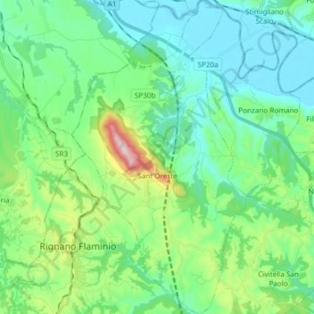
Name: Sant'Oreste topographic map, elevation, terrain.
Location: Sant'Oreste, Roma Capitale, Lazio, Italy (42.18620 12.47803 42.29700 12.56136)
Average elevation: 170 m
Minimum elevation: 27 m
Maximum elevation: 667 m
Thank you for supporting this site ❤️
Make a donation
Make a donation
Gear up for your next adventure:
As an Amazon Associate, this site earns from qualifying purchases at no extra cost to you.