Geolocate

Wardha topographic map

Click on the map to display elevation.

About this map

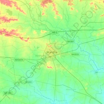
Name: Wardha topographic map, elevation, terrain.

Location: Wardha, Maharashtra, 442001, India (20.58649 78.43979 20.90649 78.75979)

Average elevation: 266 m

Minimum elevation: 224 m

Maximum elevation: 394 m

Gear up for your next adventure:

🧴Outdoor Sunscreen - High SPF protection for high-altitude UV exposure
🧼Biodegradable Camp Soap - Environmentally friendly cleaning for gear and body
🛶Waterproof Dry Bags - Keep electronics and clothes dry during river crossings
Lightweight Backpacking Tent - Compact tent for efficient hiking trips
🧥Waterproof Hiking Jacket - Protect yourself from rain and wind while hiking

As an Amazon Associate, this site earns from qualifying purchases at no extra cost to you.