
Shell Lake topographic map
Click on the map to display elevation.
About this map
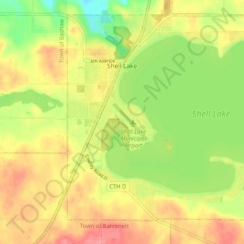
Name: Shell Lake topographic map, elevation, terrain.
Location: Shell Lake, Washburn County, Wisconsin, 53871, United States (45.71091 -91.93947 45.75361 -91.86714)
Average elevation: 376 m
Minimum elevation: 337 m
Maximum elevation: 408 m
Other topographic maps
Click on a map to view its topography, its elevation and its terrain.
Beartrap Lake
United States > Wisconsin > Washburn County > Town of Birchwood
Average elevation: 431 m