
Make a donation
Gear up for your next adventure:
As an Amazon Associate, this site earns from qualifying purchases at no extra cost to you.
Lütjensee topographic map
Click on the map to display elevation.
Make a donation
Gear up for your next adventure:
As an Amazon Associate, this site earns from qualifying purchases at no extra cost to you.
Lütjensee
Am 25. Februar 2018 wurde in Lütjensee ein Wolf gesichtet in Höhe des Restaurants Fischerklause direkt am gleichnamigen See des Dorfes. Es wird spekuliert, dass das Tier aus Mecklenburg-Vorpommern stammen und auf der Suche nach einem eigenen Revier oder Fortpflanzungspartner weiter in den Westen gewandert sein soll. Diese Sichtung lässt sich in weitere ähnliche Vorfälle einreihen. Bislang gibt es jedoch keine Bestätigung von einem sesshaften Wolfsrudel in Schleswig-Holstein.
Make a donation
Gear up for your next adventure:
As an Amazon Associate, this site earns from qualifying purchases at no extra cost to you.
About this map
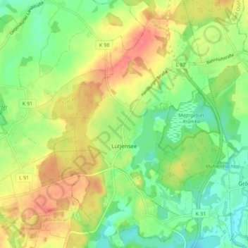
Name: Lütjensee topographic map, elevation, terrain.
Average elevation: 58 m
Minimum elevation: 31 m
Maximum elevation: 88 m
Make a donation
Gear up for your next adventure:
As an Amazon Associate, this site earns from qualifying purchases at no extra cost to you.
Other topographic maps
Click on a map to view its topography, its elevation and its terrain.
Theodor-Wulff-Höhe
Deutschland > Schleswig-Holstein > Kreis Stormarn > Barsbüttel
Average elevation: 32 m
Make a donation
Gear up for your next adventure:
As an Amazon Associate, this site earns from qualifying purchases at no extra cost to you.
Norddeutsches Tiefland
Deutschland > Schleswig-Holstein > Kreis Stormarn > Trittau
Das Euozeanische Klima prägt die Nordseeküste und die vorgelagerten Ostfriesischen Inseln und Nordfriesischen Inseln. Nach Süden schließt sich ein breiter Streifen ozeanisch (= atlantisch) bzw. subozeanisch geprägten Klimas an, der sich von der Ostküste Schleswig-Holsteins bis zu den westlichen…
Average elevation: 36 m
Make a donation
Gear up for your next adventure:
As an Amazon Associate, this site earns from qualifying purchases at no extra cost to you.