Geolocate

Wadhurst topographic map

Click on the map to display elevation.

About this map

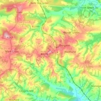
Name: Wadhurst topographic map, elevation, terrain.

Location: Wadhurst, Wealden, East Sussex, England, United Kingdom (51.02405 0.26034 51.09899 0.39791)

Average elevation: 109 m

Minimum elevation: 30 m

Maximum elevation: 198 m

Other topographic maps

Click on a map to view its topography, its elevation and its terrain.

Heathfield

United Kingdom > England > East Sussex > Wealden

Average elevation: 99 m

Blackboys

United Kingdom > England > East Sussex > Wealden

Average elevation: 71 m

Gear up for your next adventure:

🦶Hiking Shoe Insoles - Added support for high arches and long days on feet
🧥Softshell Jacket - Windproof and breathable jacket for hiking
Camping Coffee Maker - Brew fresh coffee anywhere on the topographic map
🧢Beanie Hat - Keep your head warm in cold weather
🧤Rechargeable Heated Gloves - Extreme warmth for Canadian winter expeditions

As an Amazon Associate, this site earns from qualifying purchases at no extra cost to you.