Geolocate

Tetuán topographic map

Click on the map to display elevation.

About this map

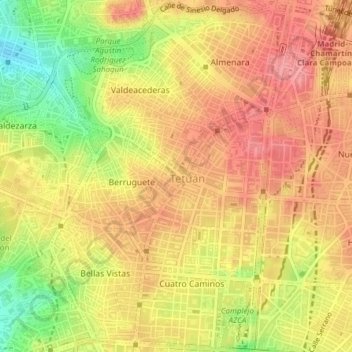
Name: Tetuán topographic map, elevation, terrain.

Location: Tetuán, Madrid, Community of Madrid, Spain (40.44621 -3.71333 40.47535 -3.68685)

Average elevation: 712 m

Minimum elevation: 654 m

Maximum elevation: 744 m

Other topographic maps

Click on a map to view its topography, its elevation and its terrain.

Madrid

Spain > Community of Madrid > Madrid

Average elevation: 650 m

Gear up for your next adventure:

🧥Softshell Hiking Jacket - The perfect balance of wind protection and breathability
🥾Trail Running Boots - Durable shoes designed for trail running
💧Filtered Water Bottle - Safe drinking water on the go
🧴Waterproofing Spray - Restore the DWR coating on jackets and tents
🧦Outdoor Socks - Durable socks designed for hiking and outdoor sports

As an Amazon Associate, this site earns from qualifying purchases at no extra cost to you.