
Thank you for supporting this site ❤️
Make a donation
Make a donation
Gear up for your next adventure:
As an Amazon Associate, this site earns from qualifying purchases at no extra cost to you.
Coín topographic map
Click on the map to display elevation.
Thank you for supporting this site ❤️
Make a donation
Make a donation
Gear up for your next adventure:
As an Amazon Associate, this site earns from qualifying purchases at no extra cost to you.
About this map
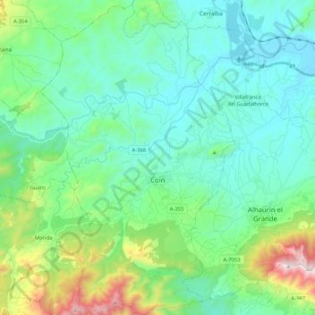
Name: Coín topographic map, elevation, terrain.
Location: Coín, Valle del Guadalhorce, Malaga, Andalusia, 29100, Spain (36.58967 -4.83295 36.75335 -4.70663)
Average elevation: 266 m
Minimum elevation: 31 m
Maximum elevation: 1,142 m
Thank you for supporting this site ❤️
Make a donation
Make a donation
Gear up for your next adventure:
As an Amazon Associate, this site earns from qualifying purchases at no extra cost to you.