Geolocate

Poltimore topographic map

Click on the map to display elevation.

About this map

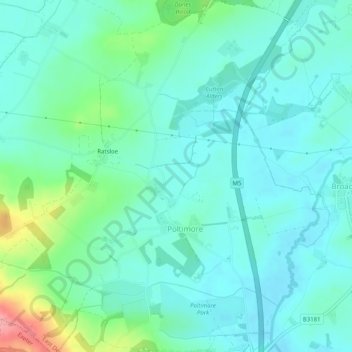
Name: Poltimore topographic map, elevation, terrain.

Location: Poltimore, East Devon, Devon, England, United Kingdom (50.75106 -3.49686 50.78288 -3.44792)

Average elevation: 34 m

Minimum elevation: 11 m

Maximum elevation: 117 m

Gear up for your next adventure:

🧴Sunscreen SPF - Broad-spectrum sunscreen for outdoor activities
🧥Waterproof Hiking Jacket - Protect yourself from rain and wind while hiking
🥾Trail Hiking Boots - Supportive boots for rough trails
💧Hydration Pack - Hands-free hydration system for long hikes
🦟Insect Repellent - Keep mosquitoes and black flies away in wooded areas

As an Amazon Associate, this site earns from qualifying purchases at no extra cost to you.